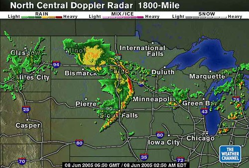
There's what the derecho looked like as of this post. Yeah, I snagged the radar image from the Weather Channel's website. The bow-shaped line of thunderstorms is the derecho itself, which is several hundred miles long, and has been moving along, intact, for a few hundred miles so far.
Why is it called a derecho, you ask, and haven't clicked on the link yet? Derecho is a Spanish word that can mean "straight ahead", as opposed to tornado, which is thought to be derived from Spanish for "to turn".
Until I read the Storm Prediction Center's Derecho Fact Page, I didn't realize that 2 years ago I experienced a derecho first hand when one formed in Arkansas and swept across Tennessee, northern Mississippi, and Northern Alabama, before it disapated into a heavy rain event. I don't remember that day, really. I vaguely remember Memphis getting the living shit pounded out of them by straight line winds, and things were a little interesting here, but we're used to that here in North Alabama.
No comments:
Post a Comment